Tierra del Fuego National Park
Tierra del Fuego National Park
Just 12 km from Ushuaia, Tierra del Fuego National Park brings together subantarctic forests, Lapataia Bay, and the symbolic terminus of Route 3 — a nature immersion at the end of the world.
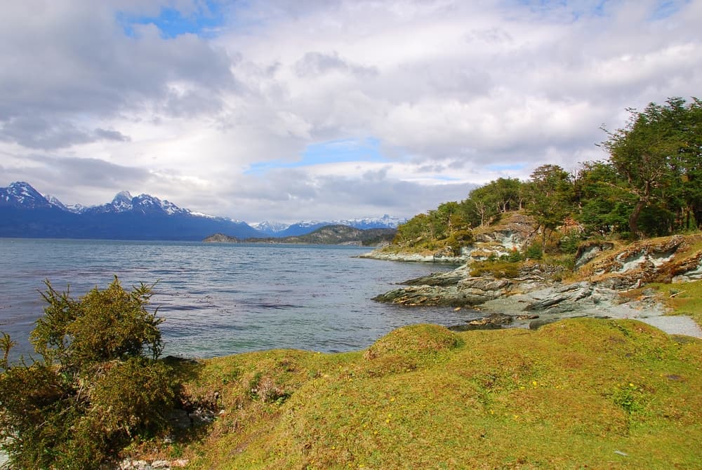
About twelve kilometers west of Ushuaia, Tierra del Fuego National Park is the only Argentine national park open onto the South Atlantic Ocean. Magellanic beech forests, peat bogs, lagoons and trout-filled rivers succeed one another all the way to the Chilean border. It is also the symbolic terminus of Route 3, Argentina's longest highway, which ends here at the bottom of the world.
Quick facts at a glance
- Entrance: paid admission; different rates for Argentine residents and foreign visitors.
- Access: Route 3 from Ushuaia; daily shuttles and tour buses from downtown.
- Recommended duration: half-day minimum; full day to combine multiple trails.
- What to wear: waterproof clothing and hiking boots essential — weather changes very quickly.
- Pets: not allowed in the park.
- Accessibility: the coastal trail at Lapataia Bay is partially accessible; forest trails are rugged.
What to see
The park covers approximately 63,000 hectares of subantarctic Patagonia. The dominant vegetation is lenga forest (Magellanic beech), spectacular in austral autumn (March-April). The shores of Beagle Channel border the park to the south; cormorants, steamer ducks, and occasionally sea otters are frequently observed here. North American beavers, introduced in the 1940s, have profoundly reshaped the landscape: their dams create characteristic ponds visible from several trails.
History and context
Founded in 1960, the park is Argentina's most southerly. The territory was long inhabited by the Yaghan (Yámana), a maritime nomadic people whose presence dates back several millennia. Early European explorers, including Fitzroy's expedition aboard the Beagle in the 1830s, charted these coasts and the channel that today bears the ship's name. The introduction of Canadian beavers, intended to develop a fur industry that never materialized, represents one of the region's most significant ecological disruptions.
Highlights of your visit
Lapataia Bay
The park's centerpiece, this sheltered bay marks the end of Route 3. A kilometer marker indicates Buenos Aires is 3,079 km away. Calm waters reflect the forest and mountains; steamer ducks patrol the waters year-round.
Roca Lake (Laguna Verde)
Accessible from the main entrance, this lake with emerald reflections is surrounded by dense forest. An easy trail circles the lake and allows close-up views of beaver dams.
Beagle Channel coastal trail
This path follows the northern shore of the channel for several kilometers. Views across to the Chilean islands and snow-capped peaks are unobstructed. It is one of the rare places where you actually walk right along the Beagle Channel shore.
Train of the End of the World
The Tren del Fin del Mundo connects a station at the park entrance to Lapataia Bay on a historic narrow-gauge line. It follows the route of an old early-20th-century penitentiary railway. The steam journey (or diesel depending on season) passes through forests and rivers.
Photography tips
Low-angle morning and late-afternoon light enhances reflections on the lakes and Beagle Channel. In austral autumn (March-April), the lengas turn red and orange: the palette is particularly photogenic from the heights of the Cerro Guanaco trail. Bring a polarizing filter to reduce water reflections. Wildlife (beavers, steamer ducks) is most active early in the morning.
Location and access
The park is located about 12 km west of downtown Ushuaia via Route 3. Regular shuttles and tour buses depart from downtown in season. You can also reach it by taxi or rental vehicle. The Tren del Fin del Mundo has its own departure station outside the park, with connections into the interior. Main trails are marked; a map is available at the entrance.
Nearby attractions
- Ushuaia — the park's gateway city and departure point for cruises to Antarctica and Chilean Tierra del Fuego.
- Beagle Channel — boat excursions from Ushuaia's port to sea lion colonies and historic lighthouses.
- Martial Glacier — accessible from Ushuaia, offering panoramic views over the city and channel from higher elevations.
- Museum of the End of the World — in Ushuaia, traces the history of the Yaghan and the colonization of Tierra del Fuego.
Frequently asked questions
The park is open year-round. Austral summer (November-February) offers the longest days and mildest temperatures. Autumn (March-April) is spectacular for beech colors. Winter lets you see the park under snow, but some trails may be closed.
Yes. The Tren del Fin del Mundo serves the park interior from a station located outside the main entrance. Many visitors take the train one way and explore trails on foot on the return, or vice versa.
Photography is permitted throughout the park for personal use. No particular restrictions are posted on the marked trails.
Camping areas are available within the park, notably near Roca Lake. It's advisable to contact park administration about availability and current rules before you go.
Tierra del Fuego weather is unpredictable: rain, wind, and sun can follow each other in just a few hours. Plan for layered clothing, a waterproof jacket, waterproof hiking boots, and a hat. Even in summer, temperatures stay cool.
Many Ushuaia agencies offer guided excursions in the park, often combined with a boat outing on Beagle Channel. Local guides provide valuable insights into the ecology and Yaghan history of the territory.

Interested in this visit?
We can include it in your personalised itinerary.