Tierra del Fuego Island
Tierra del Fuego Island
At the southernmost tip of the Americas, Tierra del Fuego brings together southern forests, glacial channels, and polar history. Ushuaia is its capital and the departure point toward landscapes at the end of the world.
Tierra del Fuego is a large island shared between Argentina and Chile at the southernmost tip of the American continent. Separated from the rest of Patagonia by the Strait of Magellan, it concentrates landscapes from the edge of the world: southern beech forests, peatlands, snow-capped mountains, and glacial channels. Ushuaia, on the Argentine side, is its capital and primary gateway. The island attracts travelers seeking wild nature, polar history, and solitude.
Quick reference information
- Main access: flights from Buenos Aires or Punta Arenas (Chile) to Ushuaia's Malvinas Argentinas International Airport.
- Best time to visit: November to March (austral summer) for hiking and wildlife; June-August for snow and winter sports.
- Recommended duration: 4 to 7 days to explore the Argentine side of the island; longer if combining with Chile.
- What to wear: waterproof clothing and thermal layers essential year-round — weather changes very quickly.
- Accessibility: limited outside Ushuaia; mountain trails and national park paths are poorly adapted for disabled visitors.
What you'll see
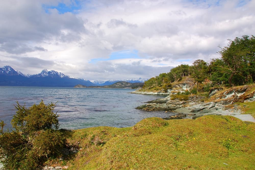
Tierra del Fuego National Park, west of Ushuaia, is Argentina's only national park with ocean access. Its trails run along the Beagle Channel, through lenga (southern beech) forests, and reach isolated lagoons. Further north, the vast steppe of Río Grande contrasts with the forested reliefs of the south. The channels and fjords on the Chilean side, accessible by boat, offer views of active glaciers.
History and context
The Yaghan and Selknam (Ona) peoples inhabited the island for millennia before the arrival of Europeans. Magellan's expedition in 1520 names the strait; fires lit by indigenous peoples on the shores inspire the name "Tierra del Fuego" (Land of Fire). In the 19th century, Anglican missions settle in Ushuaia. Argentina establishes a penal colony between 1896 and 1947 — the Ushuaia Presidio — to assert sovereignty over the region.
Visit highlights
Tierra del Fuego National Park
The coastal trail to Lapataia Bay is the most frequented. National Route 3 terminates there, with a marker indicating the end of the Pan-American Highway. Beavers introduced in the 20th century have transformed some wetland areas — their dams are visible from the trails.
Beagle Channel
Boat excursions from Ushuaia allow you to observe sea lion colonies, cormorants, and sometimes Magellanic penguins on the channel's islands. The channel separates Argentina from Chile and was charted by HMS Beagle during voyages that carried Charles Darwin.
Presidio and Ushuaia Maritime Museum
The former federal penitentiary, converted into a museum, traces the history of the prison and Antarctic expeditions. Its original cells are preserved. It is one of Patagonia's best-documented museums on the region's colonial and penal history.
Tierra Mayor Valley and winter sports
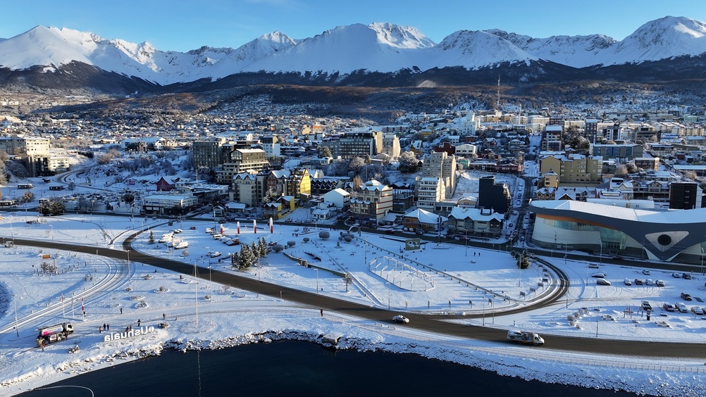
During austral winter, valleys north of Ushuaia are blanketed in snow. Cross-country skiing, snowmobiling, and dog sledding are practiced here. Cerro Castor ski center is the world's southernmost ski resort.
Photography tips
The raking light of austral summer — with late sunsets and early sunrises — creates prolonged golden tones, ideal in the evening over the Beagle Channel. Lenga forests turn red and orange in April-May (austral autumn), a photographically remarkable period. Avoid midday during strong winds: dust and fast-moving clouds complicate long exposures.
Location and access
Ushuaia is the primary gateway on the Argentine side. The airport receives direct flights from Buenos Aires (Aeroparque and Ezeiza) and Punta Arenas. National Route 3 crosses the island from north to south. Río Grande, to the north, is accessible by bus from Ushuaia in a few hours. Crossing to Chile (Porvenir or Puerto Williams) is by ferry or light aircraft. No direct road connects Ushuaia to the rest of continental Argentina without crossing Chile.
Nearby attractions
- Tierra del Fuego National Park — forests, lagoons, and Beagle Channel coast just kilometers from Ushuaia.
- Beagle Channel — historic waterway between Argentina and Chile, to be explored by boat from Ushuaia.
- Presidio and Ushuaia Maritime Museum — former federal penal colony converted into a museum in the city center.
- Cerro Castor — world's southernmost ski resort, about twenty kilometers from Ushuaia.
- Río Grande — the island's second city, departure point toward the northern steppe and estancias.
Frequently asked questions
Austral summer (November to March) offers the best conditions for hiking and wildlife watching. Autumn (April-May) is spectacular for forest colors. Winter (June-August) suits snow sports enthusiasts.
EU, Canadian, and Australian citizens generally do not need a visa to enter Argentina or Chile. Check requirements according to your nationality before planning a border crossing.
Ushuaia and Tierra del Fuego National Park are accessible by bus or shuttle from the city. To explore the northern part of the island (Río Grande, estancias), a rental car greatly facilitates travel.
A waterproof and windproof jacket is essential year-round. Pack thermal layers even in summer: temperatures can drop rapidly, especially at altitude or on the water.
Yes. Ushuaia is the main departure port for cruises to the Antarctic Peninsula. The season runs from November to March, with crossings of the Drake Passage lasting about two days.
Photography is free in Tierra del Fuego National Park for personal use. No particular restrictions are noted on the trails open to the public.
Want to discover this destination?
Our local advisors design your tailor-made trip.